


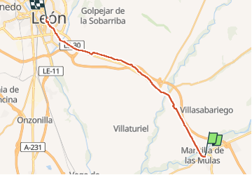
Mansilla las Mulas - Leon

emoreau
User

Length
20 km

Max alt
904 m

Uphill gradient
209 m
Km-Effort
23 km

Min alt
790 m

Downhill gradient
164 m
Boucle
No
Creation date :
2022-05-12 06:14:06.082
Updated on :
2022-05-12 12:38:47.631
6h24
Difficulty : Very difficult

FREE GPS app for hiking
 SityTrail
IGN / Geographical institutes
SityTrail Plus
The world is yours!
About
Trail Walking of 20 km to be discovered at Castile and León, Unknown, Mansilla de las Mulas. This trail is proposed by emoreau.
Description
Camino Frances
Positioning
Country:
Spain
Region :
Castile and León
Department/Province :
Unknown
Municipality :
Mansilla de las Mulas
Location:
Unknown
Start:(Dec)
Start:(UTM)
301616 ; 4708047 (30T) N.
Comments